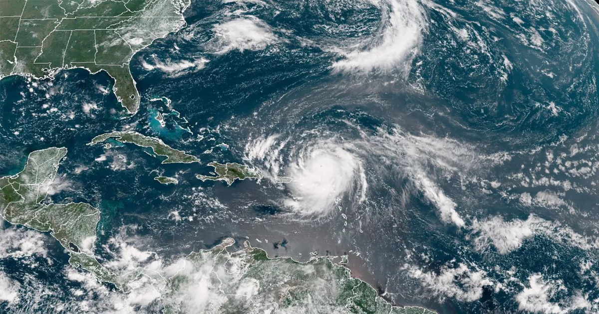
Hurricane Erin has intensified to a Category 5 storm with maximum sustained winds near 160 mph, per the National Hurricane Center.
Threat level: An earlier advisory from the hurricane center was already forecasting “life-threatening surf and rip currents,” and a new advisory is expected later Saturday afternoon.
- The storm is forecast to produce heavy rainfall through Sunday, with those dangerous surf and rip currents impacting areas along the East Coast, Bahamas’ beaches and Atlantic Canada next week, per the National Hurricane Center.
The latest: Erin, which on Friday was at a Category 1, was over the Atlantic Ocean, northeast of the Caribbean islands, as of 11 a.m. Saturday.
- It was moving toward the west near 17mph, a direction it is expected to continue in this afternoon, turn toward west/ northwest Saturday night and decrease in forward speed, turning toward the north next week.
- “Interests in Bermuda should continue to monitor the progress of Erin since there is a risk of strong winds, heavy rainfall, and high surf by the middle part of next week,” the National Hurricane Center said.
Zoom in: Hurricanes are categorized by wind speed on the Saffir-Simpson Hurricane Wind Scale, which deems a Category 5 storm one with 157 mph sustained winds or higher.
- That means “catastrophic damage will occur” including a high percentage of framed homes destroyed, downed trees and power poles and power outages lasting weeks or months, per the wind scale.
Go deeper: Erin becomes 2025’s first major hurricane as storm intensifies
Editor’s note: This story has been updated with the latest conditions.