by Mark McLean
Tue, April 29th 2025 at 4:00 PM
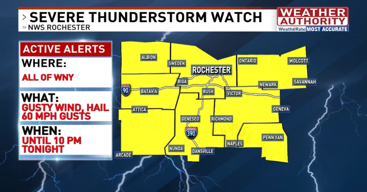
Severe thunderstorm watch.
![]() Save Story
Save Story
Rochester, NY (WHAM) – A severe thunderstorm watch has been issued for all of WNY until 10pm this evening.
As is typical in Spring, we’ll experience a change from Summer-like air today back to much cooler weather for Wednesday. A cold front crossing WNY this evening will create isolated to widely scattered thunderstorms through 8-9pm.
Some of these storms will be locally strong to severe at times. Any storms that develop will contain heavy downpours, vivid cloud to ground lightning, hail, and potential wind gusts to 60mph.
The cold front should clear WNY by 9pm this evening and push any threat of rain and thunder off to the East of Rochester. General rain amounts up to a 1/2″ are possible in any storms with isolated higher amounts in slower moving storms.
The air temperature will drop rapidly behind the cold front with most areas dipping into the upper 30s by tomorrow morning. The weather will stay dry for Wednesday.
Try downloading the 13WHAM Weather App for all of the latest severe weather information.
You can get the app by clicking here.