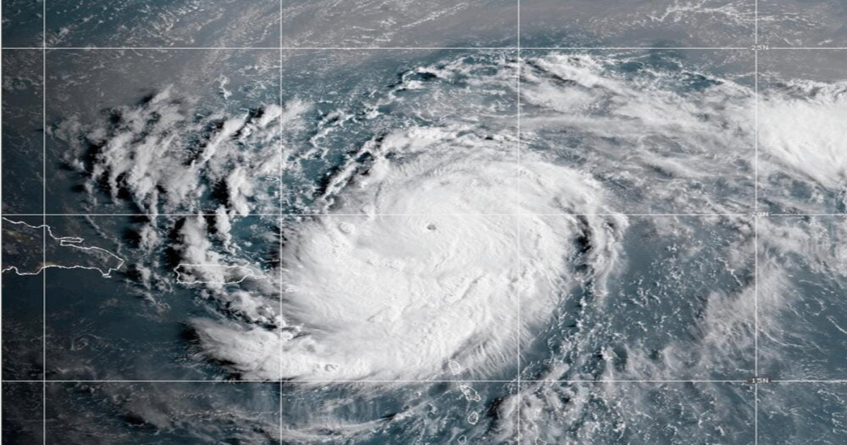
In less than nine hours, rapid intensification over the Caribbean transformed Erin from a Category 4 to a “catastrophic Category 5” hurricane, according to Miami’s National Hurricane Center.
As of 2 p.m. Aug. 16, Hurricane Erin is about 100 miles north of the Leeward Islands, or about 1,000 miles away from Florida, with maximum wind speeds near 160 mph. “The center of Erin is expected to move just north of the northern Leeward Islands, the Virgin Islands, and Puerto Rico through Sunday,” wrote the NHC in its public advisory.
Erin’s outer rainbands are now showering these islands with 2-4 inches of downpour, and up to 6 inches in some areas. Hurricane rainfall forecast can be found at https://www.nhc.noaa.gov/graphics_at5.shtml?rainqpf.
Further storm intensification is possible this afternoon. But by the the middle of next week, Erin will at least double or triple in size, resulting in tumultuous ocean conditions for the western Atlantic.
The U.S. East Coast, along with the Bahamas and Bermuda, can expect rough swells early next week that will “likely cause life-threatening surf and rip currents,” wrote the NHC in its public advisory. “Swells generated by Erin are also affecting portions of the northern Leeward Islands, the Virgin Islands, Puerto Rico, Hispaniola, and the Turks and Caicos Islands through the weekend.” Find rip current risk for the U.S. at hurricanes.gov/graphics_at5.shtml?ripCurrents.
As for where the storm is headed, Hurricane Erin forges ahead on its western track at 16 mph, but Miami’s NHC expects the hurricane will soon round a corner—turning west-northwest tonight, slowing down, then eventually turning to the north early next week.
The last Category 5 hurricane was Hurricane Milton that peaked in October last year. While it weakened to a Category 3 before it made landfall in Florida, it caused at least 16 confirmed direct fatalities and an estimated $50 billion of dollars in damages.
The National Weather Service’s guidance on how to prepare for hurricane season can be found at weather.gov/safety/hurricane.
Jillian Magtoto covers climate change and the environment in coastal Georgia. You can reach her at [email protected]
This article originally appeared on Savannah Morning News: Erin gets stronger, and will likely begin turning northwards tonight